


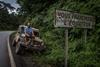
The Yuha Desert
Located in an area referred to as the Colorado Desert, (nowhere near Colorado) the Yuha desert has lots to offer historians, Geologists, and amateur explorers alike. What appears to be a vast wasteland of volcanic rocks and dry sand washes, hides some of the coolest surprises in the desert.
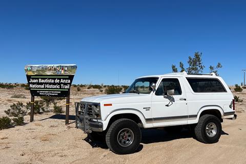
The Juan Bautista Trail
Juan Bautista De Anza Cut a path from Nogales, AZ 1200 miles to San Francisco, CA. This hearty team of immigrants were the first to establish a non-Native settlement in the San Francisco area. What does this mean for the Yuha desert? Juan Bautista led his team of 240 Men, Women, and Children right through this area. Leaving behind clues and stories of how relentless the desert environment was to traverse.
Exploring the Yuha Desert by the Numbers
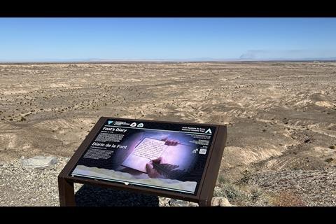
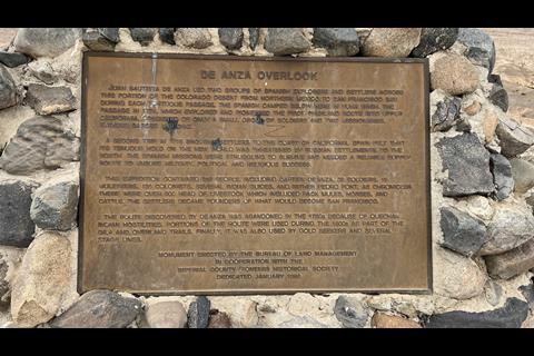
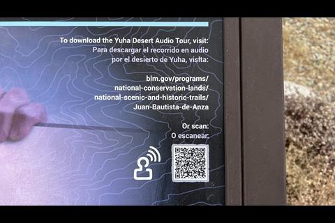
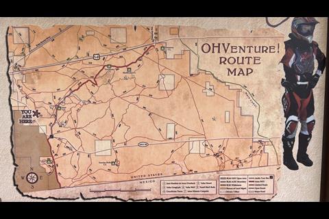
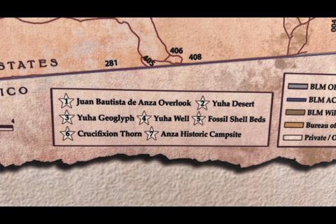
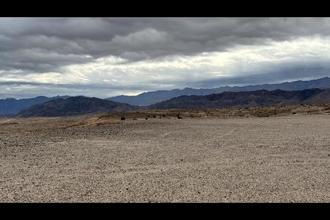
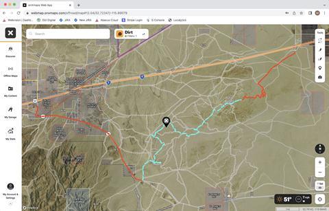
The Juan Bautista trail is a great place to start, the park service added a map with sites on it to visit. First up is the overlook. This area oversees the whole Yuha desert and gives perspective of the rugged landscape the expedition faced on the day-to-day search for water. There is also a QR code on the marker plaque that lets you listen to the experts explain what you are seeing as you travel along.
Geoglyphs, What Are They?
The most famous Geoglyphs are the Nazca lines in Southern Peru, but what are Geoglyphs? Any design or symbol built in a large format from natural materials so it can be seen from a long way away.
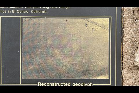
The Yuha Desert has a few protected Geoglyphs scribed into the desert asphalt high on the bluffs. As you exit your vehicle, you will notice that the largest Geoglyph has been severely damaged by vandals. This is frustrating to see as the desecration of these sacred sites makes it nearly impossible to help tell the story of the humans that came before us.
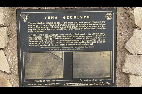
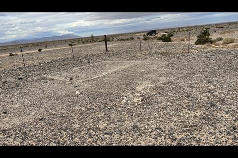
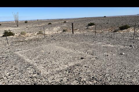
As you move over to the smaller sites, they are well preserved. You can see Geometric shapes scratched into the surface with large stones and bits of quarts mark some of the lines to help tell the story to the next visitor to that spot thousands of years ago. While this isn’t the best examples of Geoglyphs, (see Blyth Intaglios) it’s fun to visit and imagine life with no shelter living nomadically from season to season.
Ancient Sea Shores
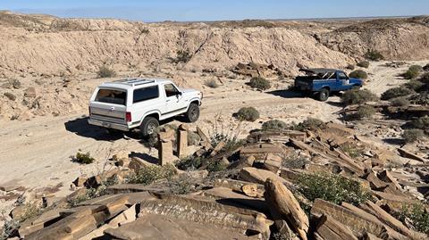
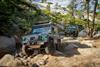
Leaving the mesa, its time to drop into the sand wash as a means to travel as Juan Bautista did in 1775. You will notice strange shaped stones that appear to be uniform in shape and yet, not man made. This is sandstone or mudstone made as Lake Cahuilla filled and dried out for thousands of years. The mud would harden, and the rain would erode the soil below the stone, and they would break into brick like structures. While its fun to dream up art projects on the side of the trail, try to refrain from rock stacking as they can be confused with navigation cairns and tamper with future archaeology. This isn’t on the list from the map, but worth mentioning.
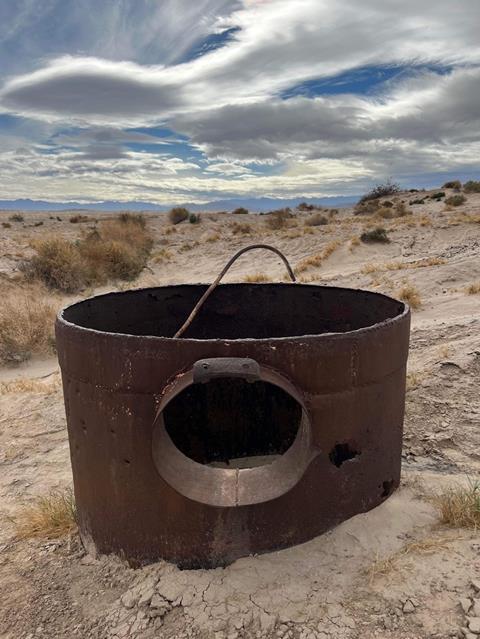
Yuha Well
Down in the sand washes we picked a fun route with plenty of twists and turns. This brings us to the Yuha Well. Historically, horses could only travel 30 miles a day without water and realistically in heat, loaded down with gear, probably half that. Humans travel even less without water. So, the local Native American tribes showed the expeditionary teams how to find water by digging near the Mesquite Hummocks. This well was originally hand dug in 1774 and maintained as immigrants and travelers alike crossed this area.
Shells in the Desert
No matter how old you are, its always amazing to find seashells in the desert. This shell bed could be millions of years old. With a quick walk around, you will find clam and oyster shells, fossils and coral. It’s tough to resist but leave the treasures where you find them and only take pictures. This will help preserve the existence of this site so others can enjoy it too.
Bonus Site
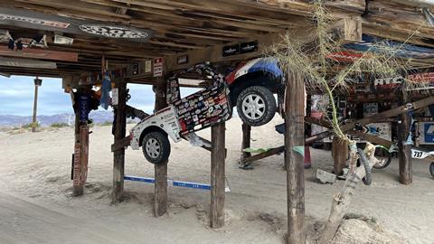
From the shell beds there are plenty of trails that lead out of the Yuha desert. We chose to continue on to Dunaway rd. so we could drive past several great camp sites worthy of a motorhome. If you would like to see something truly mysterious, head over to Evan Hewes Highway on the north side of the 8 and go southwest. You will pass plaster city, and a few more great places to explore for future day trips. Before you reach the town of Ocotillo, neatly hidden under the highway is a gem called “The Off Road Sand Bar’’. Much like some of the great watering holes in the desert, this has all the personality of a cantina in Baja. Classic race posters, trophy truck body panels, and motocross gear line the pilings of the underside of the road. Benches and tables were installed so you and your crew can relax out of the desert heat, but remember, this bar is BYOB.
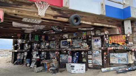
Intricately placed racing memorabilia fills the walls of the highway overpass.
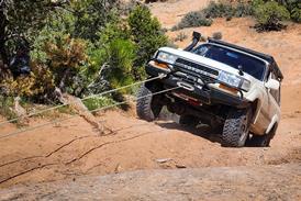
Trail Rating
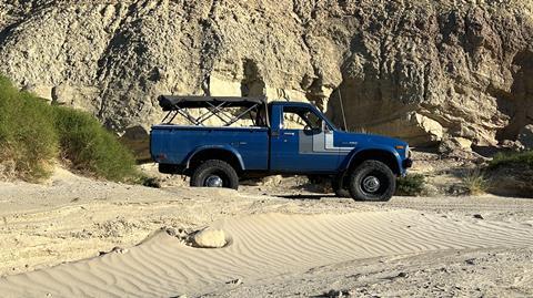
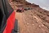
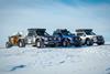
While there are easier routes to travel, we chose to run the sand washes for more adventure, we would rate this trail as 4wd SUV or Full size 4x4 pickup friendly. (Jeep owners do the best you can with what you got) You will need to air down to your vehicles extremes as we found some of the sandy areas were incredibly soft in the afternoon. You will get about 14 miles of dirt but the exploring on foot will make this an all-day trail. The closest gas station is the Chevron just off the Ocotillo exit. All of the Yuha desert is trapped between the 8 freeway and highway 98. Starting from the gas station, head south towards highway 98 and go left (east) about 6 miles. You will see a large antenna at the trailhead. This will get you on the recreational trail and align you with the GPX files in this story.
Sources
National Parts Service: Juan Bautista De Anza
Supporting documents
Click link to download and view these filesjuan-bautista-overlook-to-geoglyphs
Other, FileSizeText 23.79 kbyuha-well-to-shell-beds
Other, FileSizeText 20.46 kbshell-beds-to-dunaway-rd
Other, FileSizeText 48.16 kbgeoglyphs-to-well
Other, FileSizeText 23.13 kbgas-station-to-trailhead
Other, FileSizeText 10.99 kbhighway-to-juan-bautista-overlook
Other, FileSizeText 12.67 kb

1 Reader's comment