

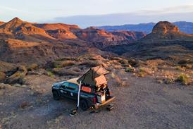
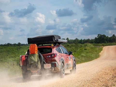
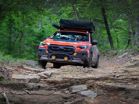
Days 8-15 of our cross-country TAT journey brought severe thunderstorms, sticky red clay, and the infamous Warloop Road as we pushed through Tennessee, Mississippi, Arkansas, and Oklahoma in our modified Subaru Crosstrek Wilderness.
In Part 1 of our TransAmerica Trail (TAT) series, written by Mercedes Lilienthal, we went through the first seven days of our TAT crossing ending in Tennessee using a mildly modified 2025 Subaru Crosstrek Wilderness.
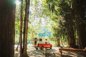
Days 8-9: Fireside Camp + Lodge Sequatchie, TN to Trace State Park, Beldon, MS
We awoke to a wet field after the night’s heavy thunderstorms. Thankfully, our Thule tent kept us safe and dry. After breakfast, we headed west again.
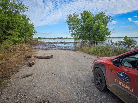
As we trekked through central Tennessee’s rural back roads (after a lightning-fast visit to the Jack Daniels distillery in Lynchburg), we encountered numerous man-made water crossings; slabs of concrete under the water intended to be driven on—something we’d never experienced.
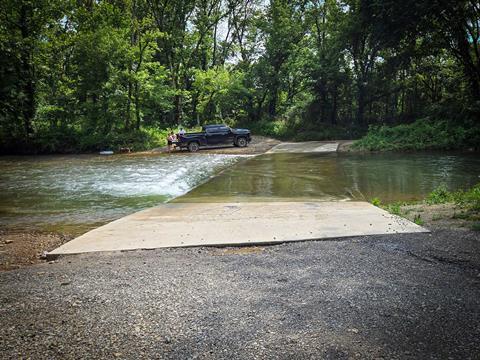
Some crossings were around two feet deep, others just a couple of inches. Families often played in the water near them, cooling off from the sweltering heat. We crossed eight of these in Tennessee and a few natural stream crossings, too. All were scoped out before crossing, just in case.
Like our first week on the road, we continued to be in Mother Nature’s crosshairs. Massive thunderheads erupted around us as we approached Waynesboro, TN.
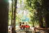
We hunted for camping, ending up in a municipal RV park with the gently flowing Hurricane Creek running through it. And while not exactly backcountry camping, the cool, shallow stream and a beer was a respite from the stinking heat.
We met locals, talked travel, and had a relaxing evening. Despite the towering thunderheads in the distance, the weather, while hot and muggy, stayed dry and calm.
For Day 9, we pressed southeast, bisecting Alabama’s northeast corner going through Waterloo and its rollercoaster-like dirt roads, then back into Tennessee around Savannah, complete with flood warnings and more thunderstorms, until dipping into Mississippi.
Here we ran into our first encounter with clay—something we were warned about. Contrasting with endless vines of green kudzu (an invasive plant that grows on everything), the red clay was like a warning to motorists. It can get so sticky that the only way to be extracted is with a tractor or dozer.
One particular section in northeast Mississippi featured a steep clay hill washed out from storms, complete with v-notches and craggy crevasses.
We plotted the best line up and switched X-MODE to Dirt/Snow. Slowly, carefully, we navigated up the daunting incline. While the clay was intermittent, the kudzu never disappeared.
We camped at Trace State Park, a beautiful recreation area on a gorgeous lake. Hot, sticky, and mosquito-infested, we made dinner, had a beer, and turned in for the night, happy we had good screens on our tent.
Milage to date: 2,051 (458.6 off road). Total hours driven: 98 hours, 40 minutes. Route deviations off the TransAmerica Trail: 11
Day 10: Trace State Park, Beldon, MS to J&M Motel, Clarendon, AR
The lake’s nearby boat ramp was abuzz with anglers at 4:00am. (Nothing says solitude like the inability to start an outboard motor.) Since we were awaken by unruly Evinrudes, we got up and grabbed showers. I also met the massive “Betsy Beetle.”
Unbeknownst to me, one of these black behemoths was on my pants. I felt scratching on my fingertip and looked down to see it chomping on my finger. Despite its attempt to eat me, I flung it off my leg and we hit the road. (No Betsy Beetles were harmed in the making of this article.)
We continued southwest on a mix of rural pavement and dirt byways, hitting the southern-most point of TAT near Tillatoba, MS. We then headed north for a BBQ lunch at Dixieland BBQ in Batesville. Sampling the local fare is a must when traveling, especially in BBQ country.
After our brisket and pulled pork, we motored through miles of farmland approaching a major milestone: crossing the Mississippi River. We took Highway 49 over the mighty river into Helena-West Helena, AR. Once a river town, much of the city had fallen on hard times. We stopped at a beautiful river area to take photos marking our milestone, and got back on TAT.
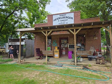
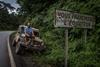
About 30 miles outside of Helena-West Helena was the “TAT Stop,” a well-known waypoint for TAT travelers. Located in Trenton, AR, the unofficial TAT landmark had a guestbook, outlets to charge electronics, a mock jail, and windows covered in stickers from visitors. These TAT waypoints make you realize you’re not just crossing the country; you’re on the TransAmerica Trail.
Hurtling into the Arkansas countryside we, yet again, head into severe weather. Unlike the previous 10 days, we couldn’t avoid this line of storms. Before we started TAT, Mercedes and I agreed if the weather was potentially dangerous, we’d get a motel, and this would be the case today. The only option in Clarendon, AR? The J&M Motel. Without a website to book on, we called ahead and got a room.
As we headed toward town, the sky became as black as Arkansas asphalt, and thunder rang out as a warning that things were about to get gnarly. Rain started pouring in sheets, and I turned on our Baja Designs XL-R Pro lights for visibility.
I turned on our hazards and crawled down US Highway 79, wipers on high, though proving useless. The rain slowed as we entered Clarendon, and J&M’s parking lot was a small pond.
Mary (the M in J&M) and her husband had run this motel for nearly 40 years, and she was great. (There was even a TAT decal on the front door.) The room was dated but air conditioned, and we were thankfully out of harm’s way.
Milage to date: 2,341 (571 off road). Total hours driven: 111 hours, 15 minutes. Route deviations off the TransAmerica Trail: 13
Days 11-13: J&M Motel, Clarendon, AR to Post Oak Campground, Copan, OK
We left the J&M, eventually going through the Mike Freeze Wattensaw Wildlife Management Area, and discovering the most amazing lily pond. Located just off I-40, it was packed with blooming lotuses. It was a hidden gem of tranquility, off a dirt road, near a bustling motorway.
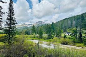
We were now in the Ozarks, including the Boston Mountains and Ozark National Forest. A new place for us, this iconic area was a treat. Its natural beauty, complete with rolling hills and thick deciduous forests, didn’t disappoint.
We were, yet again trying to avoid bad storms, which were popping up all around us. We didn’t want to be on winding, remote trails in severe weather. We had to find camping … or another motel? We shot for Ozone Recreation Area & Campground.
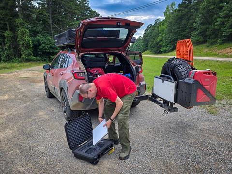
The sky was getting black again near Ozone; there was an eerie calmness before an impending storm. We had no phone service, so we quickly pulled our Starlink Mini out of its Pelican case, deployed it, and connected. We checked our radar app: the area was going to get walloped. We threw the Starlink in car and raced south to Clarksville for another night in a motel.
Just as we arrived, the winds hit and the skies opened up. Soon, the motel parking lot looked like a lake. Thunder roared and lightning flashed. The hotel lost power briefly. While we’d rather camp, we’d rather be safe. We didn’t want trees to topple on our tent. We agreed we made the right decision.
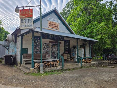
The next morning we hit the road before breakfast, aiming to get our first meal at the legendary Oark General Store about 25 miles away.
This place is a must-stop. Thought to have been built in 1890, they sell just about everything. They are best known for their burgers and pies, but the breakfasts are great, too.
There we got intel from a local named Dan, who’d ridden the Arkansas TAT on his Kawasaki KLR650. He warned us of one of TAT’s infamous obstacles: Warloop Rd.
We heard stories of boulders, drop offs, and difficult passages. He didn’t think our Subaru would be up for the task and told us how to bypass it. We thought we’d at least check it out.
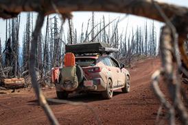
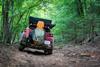
Warloop Rd. is a dirt trail with short and technical rock-riddled stretches. It could be especially in an AWD vehicle. But I was confident in my driving skills and the Crosstrek’s ability. We had to be cognizant of where we placed wheels, the trail’s width, and drop offs. We also always ensured we could back out if needed.
With tires aired down and X-MODE in full effect, we chose lines carefully, with Mercedes spotting me at times. We put the Primitive Racing Skid Plates to good use here, as we traversed this tricky track. Even the Rally Innovations Light Bar took some hits, but came out unscathed.
Impressively, we conquered Warloop and our spirits were stratospheric. But we didn’t have time to celebrate, we had miles to make. Later that night, we made camp at Natural Falls State Park across the border in Oklahoma.
There we experienced an epic sunset and a distinct lack of bugs. (We were testing out a heat-it for insect bites, and it worked great, but no need that night.)
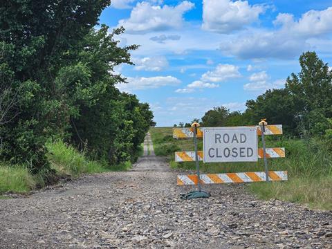
The next day we did much needed laundry, then headed west. Eastern Oklahoma was affected by flooding weeks prior. Roadways had lakes and rivers over them; bridges were washed out.
This required countless workarounds and route deviations, making navigation tedious and progress slow. But progress is progress.
After driving all day, exhausted, we opted for dinner out in Bartlesville, OK. Then we drove to a free campsite on Copan Lake, only to find it gated due to flooding. We ended up at Post Oak Campground about five miles south of the Kansas border.
The flooding had caused a boil order for the campground and part of it was also under water. However, it was available, quiet, and had a friendly camp host.
Mileage to date: 3,055 miles (892.9 off-road). Hours: 148 hours, 25 minutes. Route deviations off of the TransAmerica Trail: 20
Days 14-15: Post Oak Recreation Area, Copan, OK to Great Plains Bunk House Boise City, OK
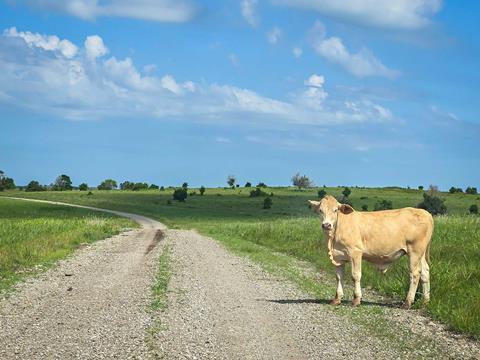
Oklahoma was the flattest state we’d visited. After leaving the east, most roads were gridded out like a waffle iron. This allowed for easier rerouting when encountering a flooded road: Just go north or south, then continue west, eventually getting back on the TAT.
The Sooner State’s fields have a beauty of their own and allowed us to travel at a faster pace than the Ozarks or Appalachia.
After a day of navigating agricultural roads and small farm towns, we camped at western Oklahoma’s Boiling Springs State Park, a beautiful vast campground (complete with resident armadillos) featuring modern facilities that were akin to those we’ve found in Europe.
Day 15 was much like day 14: gridded farm roads, lots of dirt, and storms on the horizon. With one eye on the sky and the other on the lookout for deep clay, we pressed west. Thankfully, we only had one bog of clay and made it through without getting stuck.
As luck would have it, we reached The Great Plains Bunk House, another TAT staple, in time to end the day. They welcomed tent camping as well as renting out rooms.
We were the only people there which made it feel like we’d reached a far-off outpost in the middle of nowhere. There was a communal lounge with Wi-Fi, a kitchen, and a barn with a piano, games, a shower, toilet, and more. There were playful kittens and a cool old grain bin turned into gazebo where we’d set up camp. It was super and inexpensive.

With the horizon getting darker due to storms, we quickly set up our roof top tent and got ready for rain. For the first time in 15 days, the weather got cool enough to wear long pants and hoodies. The humidity disappeared, and it was finally livable outside.
We caught up on emails, had dinner, and played with the resident felines. This place was great and a fitting end to traveling across the central part of the country.
Mileage to date: 3,675 (1,216.7 off-road). Hours: 169 hours, 25 minutes. Route deviations off the TransAmerica Trail: 27.
Next up is the western portion of TAT, which would undoubtedly be our biggest challenge. Stay tuned for our final installment in Part 3.
Access More Great Stories!
For more informative articles like this, consider subscribing to OVR Magazine in print or digital versions here. You can also find the print edition of OVR at your local newsstand by using our Magazine Finder.

No comments yet