



Built by borax baron Francis Marion Smith in the early 1900s and abandoned after a single catastrophic failure, the Old Traction Road disappeared into the Mojave Desert for over a century. Honoring the dying wish of renowned desert historian Dennis Casebier, explorer Billy Creech led a three-day expedition backed by the Bureau of Land Management and The Explorers Club to retrace, document, and reopen this forgotten 125-mile route — and in doing so, close the final chapter on one of the Mojave’s greatest untold stories.
While many people travel the globe in search of adventure, sometimes the most compelling journeys are hiding in our own backyard.
The Old Traction Road is one of them—a route built at the beginning of the 20th century by mining magnate Francis Marion “Borax” Smith across the hostile terrain of California’s Mojave Desert.
The road was intended to transform the way borax ore moved from Death Valley to the railroad. Instead, the technology it was built to support failed almost immediately. The route faded from maps, much of its path disappeared into the desert, and the Old Traction Road became a little-known chapter of Mojave Desert history.
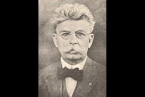
One person who understood its significance was acclaimed desert historian and explorer Dennis Casebier. He founded the Friends of the Mojave Road, known today as the Mojave Desert Heritage and Cultural Association (MDHCA), and helped establish the Goffs Schoolhouse as a center for preserving the region’s history near Needles, California.
Casebier’s legacy includes routing, opening and writing guidebooks for the famed Mojave Road, along with developing the East Mojave Heritage Trail.
In 2019, MDHCA president Billy Creech helped reroute the latter to avoid areas closed to motorized travel. If those two routes represented the first chapters of Casebier’s Mojave Desert trail trilogy, the long-lost Old Traction Road was the unfinished third.
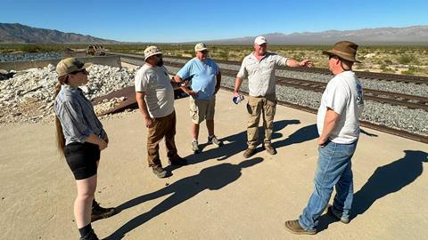
Before his death in 2021, Casebier expressed his hope that Creech would complete the work by remapping the Old Traction Road to modern standards.
That meant finding a route that followed the historic trace as closely as possible while respecting private property, designated Wilderness and sensitive cultural and ecological resources.
Borax Smith’s Plan for a Better Road Across the Mojave
Borax Smith was famous for using twenty-mule teams—actually 18 mules and two horses—to haul raw borax from Death Valley mines to distant railheads.
Measuring roughly 180 feet long, each team typically pulled two ore wagons and a 1,200-gallon water wagon. The complete load could exceed 36.5 short tons, or 73,200 pounds, making it one of the largest routinely transported by draft animals.
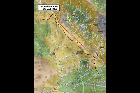


Borax was a lucrative commodity with household and industrial applications ranging from soap, toothpaste and pesticides to welding flux, gold extraction, enamel glazes and glassmaking.
When Smith needed to move ore from the Lila C Mine at the southern end of Death Valley, however, the most convenient rail connection was approximately 110 miles southeast at Ivanpah No. 2.
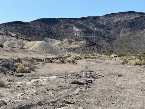
The siding stood near present-day Interstate 15 at the California-Nevada state line, an area now passed daily by motorists traveling between Los Angeles and Las Vegas.
Building a railroad was enormously expensive, while mule teams were slow and required considerable food, water and manpower. A new technology known as a traction engine appeared to offer another way.

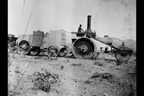
If Smith could build a hard-surfaced road across the desert, a mechanized hauler promised to carry more ore at a faster pace without the expense of laying track.
Smith commissioned the road for $100,000, the equivalent of more than $3.6 million today. Construction took three years and covered the entire 110-mile distance.
Newspapers heralded the project as a technical achievement that might make both twenty-mule teams and railroads obsolete.
With the Old Traction Road complete, Smith put an experimental Gibbs tractor into service. The gasoline-powered machine generated electricity for motors that drove the wheels of the ore carts behind it.

In theory, it could travel three times faster than a mule team while carrying four times the payload. In practice, its engine failed almost immediately.
Smith was unwilling to abandon such a substantial investment. He had a Daniel Best steam tractor named Old Dinah shipped from Daggett to Ivanpah No. 2.
The machine had previously hauled ore from the mines at Borate, but its inability to cross deep sand or climb steep grades had already led to its abandonment.
In late 1903 or early 1904, Old Dinah was pressed into service once more. The steam tractor covered just 14 miles of the Old Traction Road before blowing a boiler flue on Ivanpah Lake.
That failure effectively ended Smith’s experiment. He later developed the Tonopah and Tidewater Railroad, which served the region from 1907 to 1940.
Old Dinah endured a few more unsuccessful assignments before sitting abandoned for nearly 50 years.
Today, the steam tractor is displayed at Furnace Creek in Death Valley National Park, a surviving artifact of a transportation idea that was ahead of the machinery required to make it work.
How the Old Traction Road Disappeared
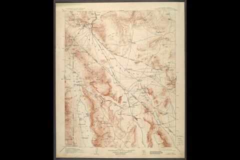
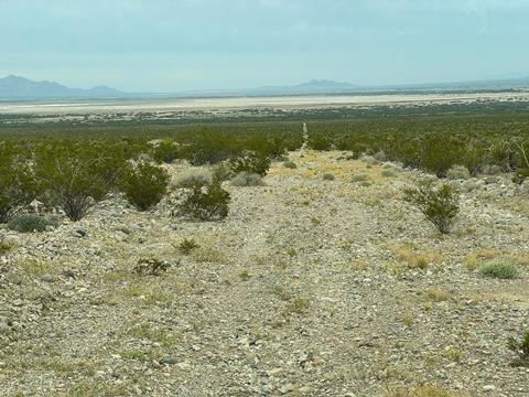
The Old Traction Road last appeared on a U.S. Geological Survey map in 1912. Once it vanished from government maps, the route began a slow return to the desert.
Local travelers continued to use portions of it, but the complete road was essentially abandoned for more than a century.
The landscape changed around it. Private properties were established, energy projects rose from the desert, highways altered access points and designated Wilderness areas were created to protect fragile habitat.
The Mojave is home to 13 threatened or endangered species, and portions of the historic trace now pass through or near land where motorized travel is prohibited.
Despite being bracketed by major population centers, the Old Traction Road remained remarkably remote. More than 10 million people live within the broader region surrounding it, yet long stretches of the route faded into little more than faint two-tracks, overgrown vegetation and low rock berms.
Planning a Compliant Old Traction Road Retrace
Inspired by Casebier and motivated by his passing, Creech began laying the groundwork to complete the missing route. The goal was not simply to drive the original line.

It was to retrace the Old Traction Road as closely as possible while avoiding private property and designated Wilderness, documenting sensitive resources and identifying a compliant path that public-land agencies could evaluate for future backcountry use.
Building a working partnership with the Bureau of Land Management took months. The resulting expedition would combine historic research and four-wheel-drive travel with scientific study.
Creech assembled a team that included BLM personnel Mike Ahrens, Chris Dalu, Nicole Keefner and Rose Pettiette; photojournalist Chris Collard and his assistant, Will Corbett; and the author of this story.
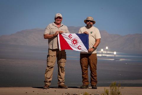
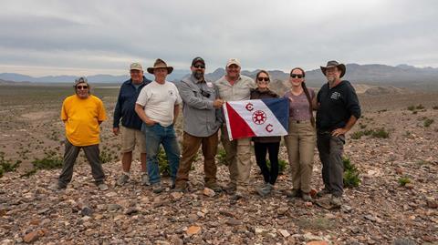
The project also earned recognition from The Explorers Club, the international organization devoted to field research and exploration. The club awarded the team Flag No. 238 to carry during the expedition.
Its Rolex committee also entrusted Creech, a Fellow of The Explorers Club and the Royal Geographical Society, with Rolex Explorer watch No. 1. At the time of the expedition, only five others had been awarded the watch, underscoring the scientific and historical significance of the mission.
Day One: From Ivanpah Into the Mojave Mountains
Our expedition began at the Goffs Schoolhouse, where we departed early and headed north to Searchlight, Nevada.
There we met the BLM team and topped off our fuel tanks before following a short section of the East Mojave Heritage Trail toward Ivanpah No. 2, the former Santa Fe Railway siding and southeastern terminus of the Old Traction Road.
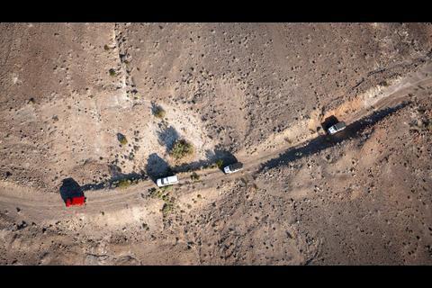
From that point forward, Midland radios kept the convoy in constant communication.
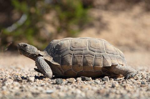
After a team briefing at Ivanpah No. 2, we headed toward Nipton on an existing portion of the historic route before turning toward the state line. BLM field manager Mike Ahrens soon spotted a protected Mojave desert tortoise near the road.
Following established handling protocols, the team moved it out of danger while BLM biologist Keefner measured the animal and documented its location. Desert tortoises face threats from habitat loss, predators and vehicle traffic, making accurate route planning especially important in this part of the Mojave.
The existing road toward Primm was well traveled and, other than patches of silt, allowed us to cover 26 miles before lunch. The second half of the day was far less accommodating.
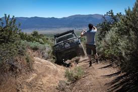
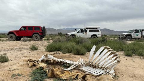
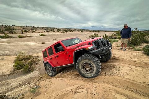
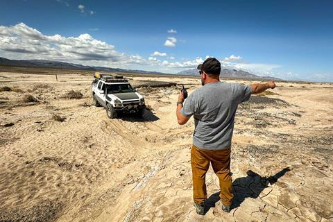
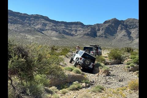
As we left the desert floor and climbed into the mountains, we reacquired the Old Traction Road and immediately encountered severe erosion from recent storms. Progress slowed, and much of the route had to be walked before the vehicles moved forward.
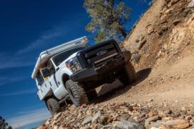
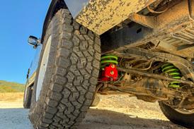
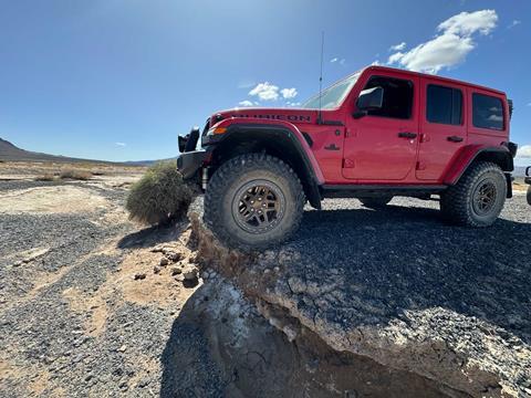
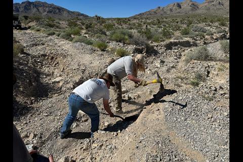
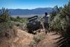
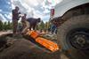
Vehicle-sized washouts and substantial cross ditches challenged the stock four-wheel drives in the group. More than once, we used hand tools to reshape an eroded bank just enough to make it passable.
During one foot reconnaissance, BLM archaeologist Chris Dalu located two previously undocumented Native American sites. One was a “spirit portal,” a circle of rocks placed on an elevated ledge.
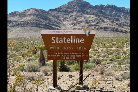
The other was a cave complex on the southern face of a slope above the original road trace. The caves were visible but lay within designated Wilderness, so we remained on a parallel route outside the boundary. Late in the day, we crossed an alluvial fan, following its relentless rises and dips for what felt like hours.
As the sun dropped, Collard’s first-generation Toyota Tacoma developed a charging problem. The terrain had become difficult enough that we chose a campsite and began diagnosing the issue while daylight remained.
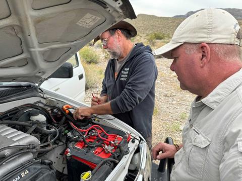
After identifying the alternator as the culprit, the team installed a spare Collard had brought. We ended the day with greasy hands and fewer than 10 additional miles behind us.
Day Two: Washouts, Private Land and a Blocked Route
Morning brought a richly colored sky and a moment to wonder whether early travelers had admired the same view. We checked the previous night’s repair and started the Tacoma.
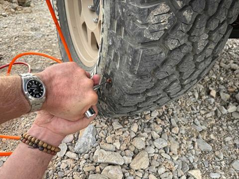
While it warmed up and replenished its batteries, Creech found a slow leak in the right-front tire of his Chevrolet Avalanche and repaired it with a plug. With every vehicle operational again, we resumed the Old Traction Road retrace determined to improve on the previous day’s mileage.
One of the largest questions involved connecting two parallel tracks while avoiding private property and remaining as close to the original road as possible.

During pre-trip planning, we had identified a potential right of way with onX and its property-ownership layer. The proposed connector proved viable, and with BLM authorization, the convoy continued north on public land.
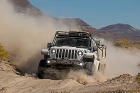
After a quick stop in Sandy Valley, we traveled along the California-Nevada border through rugged, storm-damaged terrain. The road repeatedly disappeared beneath vegetation and erosion, only to reappear farther ahead.
Digital mapping helped keep us aligned with the historic corridor. Where necessary and authorized, the team performed minor trail work to establish a path that the stock BLM vehicles could negotiate.
We eventually entered an enormous floodplain cut by several deep but dry riverbeds. At one crossing, evidence suggested the recent flow had reached approximately 15 feet, including 3 to 4 feet above the banks, where desert vegetation had been flattened in the direction of the current.
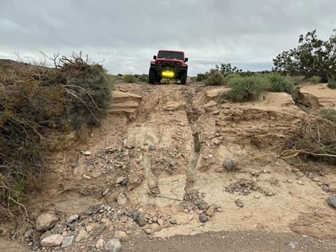
Elsewhere, the road ended at a sudden 6- to 8-foot drop into a wash. Careful work on the bank allowed every vehicle to cross.
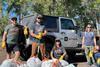
Deep sand and wide washes gave way to firmer two-tracks as we climbed out of the floodplain. Once we reached faster roads, we made up considerable time. Atop the highest hill in the area, the group paused for a photograph with The Explorers Club Flag No. 238.
Near the end of the day, the route required a brief stretch of pavement before returning to dirt. A recent highway repair had created a tall berm and severed the apparent access point to the Old Traction Road.
After an hour of studying the maps without finding an alternative, a local resident stopped to ask what we were doing. He warned that the road beyond was impassable, with 10-foot drops and washouts just out of sight. In his words, “You won’t make it.”
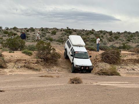
Feeling the weight of a potentially failed mission, we made camp after approximately 50 miles of progress.
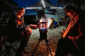
Two massive thunderstorms built around us but passed on opposite sides of camp, delivering a spectacular light show while we considered our options.

Day Three: Lila C Mine and the Search for a Connection
The highway project had seemingly split the route in two, but overnight we developed another plan. We would drive roughly 27 miles on pavement to the Lila C Mine, the northwestern terminus of the Old Traction Road, then follow the route backward in hopes of finding the missing connection from the other side.
From State Route 127 at Death Valley Junction, we turned southeast toward the historic Lila C Mine and rejoined the final segment of the road. The size of the mine surprised us.
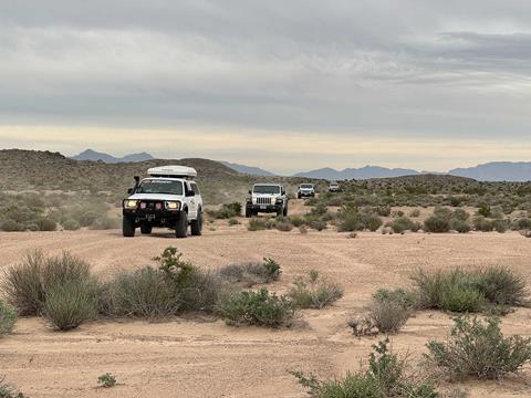
Remnants of its original infrastructure remained among period cans and debris, along with the berm of the Tonopah and Tidewater Railroad that succeeded the Old Traction Road.
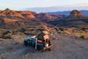
The southern edge of Death Valley offers extraordinary scenery and remote camping opportunities. We had hoped to visit Old Dinah at Furnace Creek, but storm damage had closed the roads into the park for repairs. With our frustration mounting, we returned to the trail and began working east in search of a connection.
Our first major challenge was crossing the broad Amargosa River channel south of Carson Slough. The river had recently flowed above ground but was dry during our visit.
Flooding had left deep channels and nearly vertical banks throughout the riverbed. Our planned line remained remarkably accurate, and as we followed it, the Old Traction Road continued to reveal itself.
The conditions reinforced the seriousness of remote Mojave Desert overlanding. Weather can transform dry washes with little warning, and the route should never be approached casually or alone.
Travelers must confirm current land-use designations, closures and conditions with the appropriate public-land agencies before entering any segment.
Climbing out of the Amargosa, we crossed another alluvial fan where progress slowed to a crawl. The route improved in the hills, allowing us to recover some time as daylight began to fade.
Heavy vegetation and the condition of the track suggested that ours were the first vehicles to pass through in decades. Small rock berms bordering the old road provided one of the few confirmations that we remained on the historic trace.

In this area, Dalu identified another undocumented Native American site, while BLM geologist Rose Pettiette located a U.S. General Land Office survey marker dating to 1928. Each discovery added another layer to the expedition’s scientific and historical record.
Completing the 125-Mile Old Traction Road Retrace
Our final test was reaching the highway from the side opposite the berm that had stopped us the day before. After approximately 40 miles of four-wheel-drive travel, we closed in on the pavement and discovered that just 50 feet and a tall embankment separated us from completing the route.
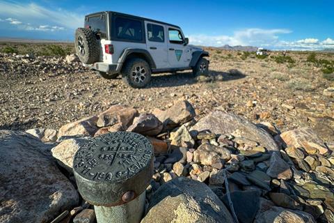
We walked ahead to inspect the roadside and found it: a ramped access point that could not be seen from our previous position. The discovery allowed us to close the gap and complete a GPS-backed retrace of the Old Traction Road.
Changes required to avoid private property and designated Wilderness had increased the historic 110-mile path to approximately 125 miles.
The recording could now be provided to public-land agencies for review, completing the fieldwork behind Casebier’s Mojave Desert trail trilogy.
It was the product of years of planning and research, along with a public-private partnership involving the Bureau of Land Management, the Mojave Desert Heritage and Cultural Association, The Explorers Club and Rolex.
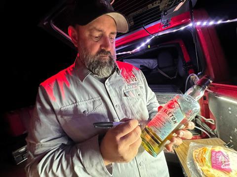
As daylight waned on Day Three, the significance of the moment settled over the team. We had followed a transportation experiment abandoned more than a century earlier, documented cultural and natural resources, and demonstrated how historians, explorers and land managers could work together to pursue responsible access without losing sight of conservation.
The Old Traction Road’s future ultimately rests with the agencies responsible for the land it crosses.
Our hope is that the expedition’s research and GPS data will help preserve both the story and a compliant path through this remarkable corner of the Mojave Desert, allowing future generations to experience the route without damaging the resources that make it worth protecting.
Editor’s Note
The Old Traction Road passes near private property, designated Wilderness and environmentally sensitive areas. Confirm current maps, closures, land-use rules and route status with the appropriate managing agencies before attempting any portion of it. To support the preservation of Mojave Desert history and trails, consider donating to or becoming a member of the Mojave Desert Heritage and Cultural Association.
Rediscovering the Mojave’s Long-Lost Old Traction Road Image Gallery



Sources
- Mojave Desert Heritage and Cultural Association
- onX Maps
Access More Great Stories!
This article originally appeared in OVR Issue 09. For more informative articles like this, consider subscribing to OVR Magazine in print or digital versions here. You can also find the print edition of OVR at your local newsstand by using our Magazine Finder.


No comments yet