

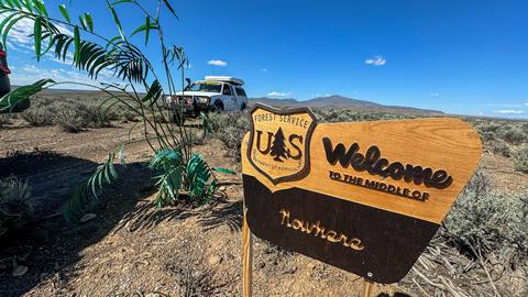
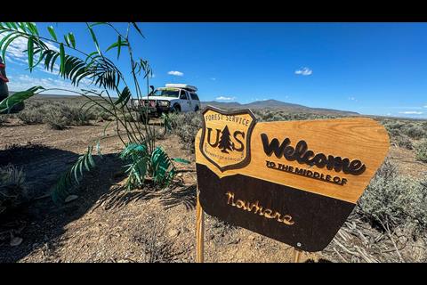
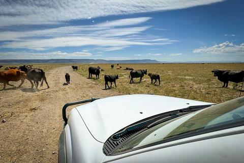
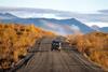
Southeastern Oregon remains one of America’s most unpopulated regions—a vast expanse of high desert, volcanic mountains, and alkali flats where cattle barons built empires, outlaws made their final stands, and the spirit of the Wild West refuses to die. We traced 700 miles of remote two-tracks through a land of ghost towns, hot springs, and headlines, discovering that out here, history isn’t something you read about—it’s something you drive through.
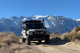
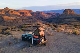
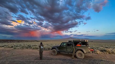
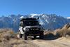
The altimeter was falling like a lead zeppelin as a stiff wind whipped over the top of the mountain, buffeting the side of my rig as I carefully navigated a hairpin switchback. To our left, the terrain disappeared into a precipitous abyss, and 1,500 feet below lay the desiccated and bleached expanse of the Alvord Desert.
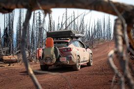
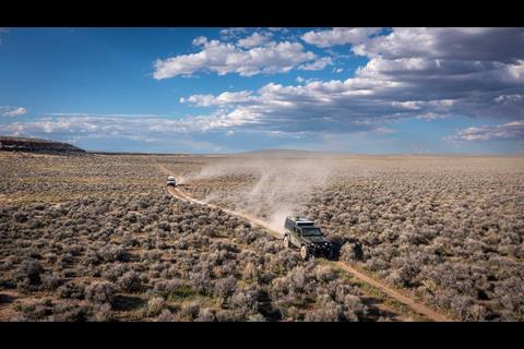
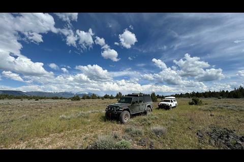
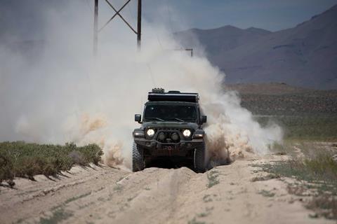
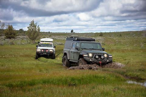
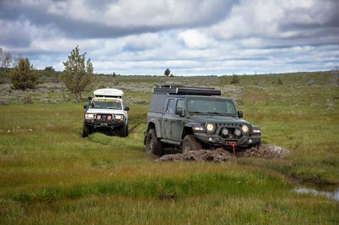
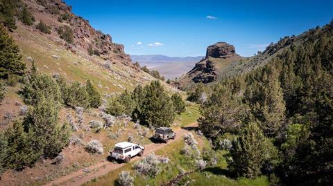
Similar to the 250 miles of remote two-tracks we had already covered, it had been some time since this road received much traffic. If we were on point, the next 300 hundred miles would be equally lonely.
I’d received an invite from the guys at Differential Communication (Firestone Tire’s PR firm) to join them on a trek through Southeastern Oregon.
Their goal was to identify a route for an upcoming media program, and the only intel received was that we’d meet in Plush (population 67) in east-central Oregon and end up near the Idaho border. The rest would be an open book.
Opening my Delorme Atlas revealed an expansive area mostly void of townships, and large swaths of white space between paved roads. Other than the Hart Mountain area, this would be new country for me, but as I dragged my finger east familiar names appeared.
Frenchglen, Steen Mountains, Alvord Desert, Malheur National Wildlife Refuge, and Paradise Valley—the latter two sparking memories of national headlines, militia occupation, and murder.
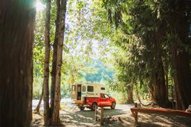
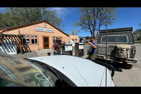
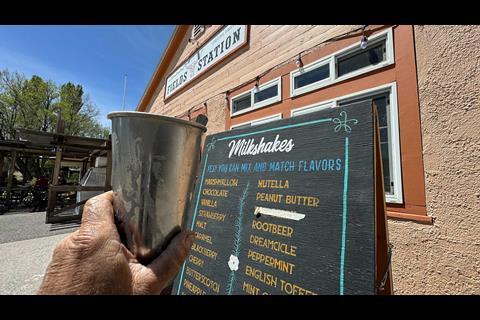
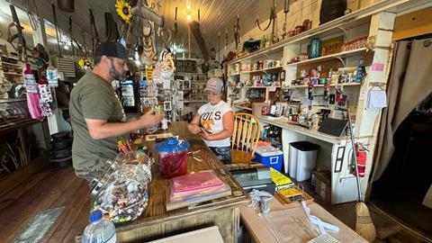
Plush is a one-horse, or one-pump town. Similar to many remote outposts, the gas pump is outside the saloon, which serves as the grocery and hardware store, restaurant, and community gathering place. It’s the kind of place where the price indicator on the pump died long ago.
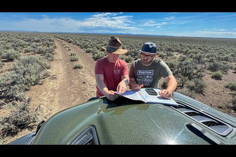
An index card with the current cost can be found taped above the meter and they simply ask, “How much did you get?” My co-pilot and long-time travel buddy, Will Corbett, and I topped off the tank and jerry cans, and wandered in to pay the tab and check out the digs. Justin Ashcroft and his Jeep Gladiator Rubicon rolled in a few minutes later and we pulled out the maps.
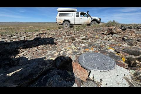
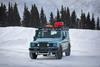
I was familiar with the southern access to Hart Mountain National Antelope Refuge, having run the rocky two-track up Fisher Canyon 15 years prior during an all-dirt trek from Mexico to Canada. But with late snow and heavy runoff, the route might be closed at the top. Rather than chancing a long backtrack, we entered the park from the north.
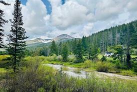
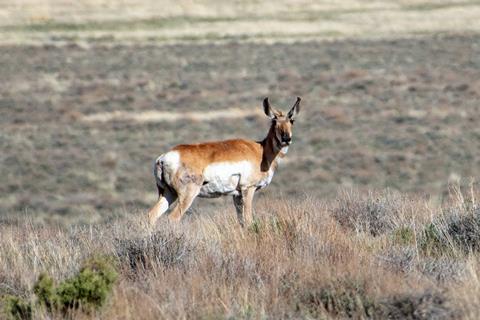
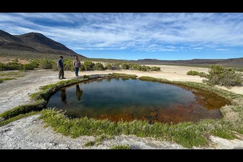
Established in 1936 to protect pronghorn antelope populations (they are technically not an antelope), the reserve stretches out over 400 square miles of high-desert sage. In addition to great camping (dispersed and managed) and hot springs, it hosts bighorn sheep, mule deer, and hundreds of miles of dirt byways.
Our gut was correct…a gate and big fat padlock at the Fisher Canyon Trail terminus would have turned us back. Not a big deal, a thousand miles of unknown tracks lay to the east.
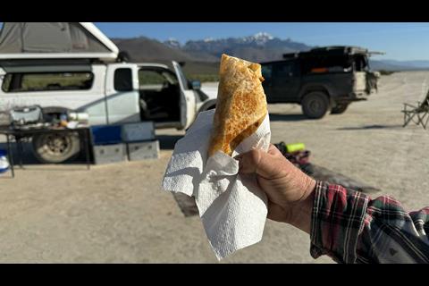
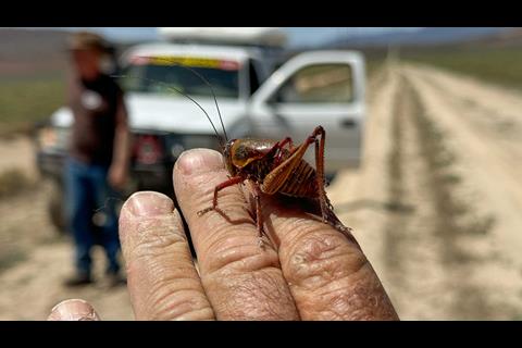
This moment gave me pause, as I’ve heard a hundred self-proclaimed “experts” define overlanding as all about having the “proper” gear, preparing a tactical meal (or potty) plan, and rigid agendas. I don’t buy into that nonsense…and what the heck is a tactical meal plan? When you get hungry, pull out the PB&J and make a sandwich.
Being prepared is essential, but in my humble opinion one of the most important elements of backcountry travel is mental flexibility. When you come to a fork in the road, take it. If a local says, “XYZ is spectacular,” go check it out, and don’t be afraid to follow a thin line on your map that wasn’t confirmed by others on a newfangled phone app. Enough said…we pulled out the map.
There were several tracks leading southeast, and we found one that appeared to connect with DL Spring Road, which would take us east toward Roaring Spring Ranch.
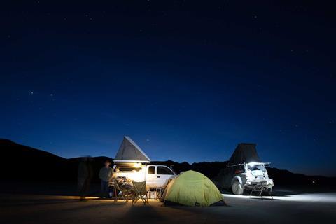
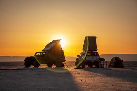
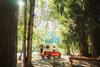
As the sun neared the horizon, we set up camp next to a hunting blind, cracked a few Pacificos, and took in a Kodachrome sunset as a thunderstorm crossed a distant range.
Eastern Oregon’s Land of Cattle Kings and Outlaws Image Gallery

Murder and Mystery
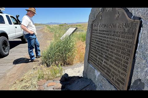
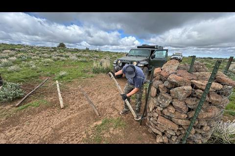
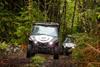
This region is a checkerboard of public BLM land and private holdings crisscrossed by countless two-tracks. Signage is somewhat ambiguous, and we found ourselves trespassing on the Roaring Springs Ranch.

Stopping at an intersection to reference our maps, a weathered old cowboy rolled up in a Ford pickup. He firmly apprised us of our infraction, but shared a few words about the dirt we were standing on.
In the 1860s, a trapper named Porter wandered into what is now known as the Catlow Valley. With dreams of being a cattle man, he staked a claim under the newly drafted Homestead Act of 1862. Porter slowly expanded his original 160 acres, known as the P Ranch, until selling it to Hugh Glenn, a prominent California wheat farmer in 1872.
Glenn dispatched his son-in-law John “Pete” French with 1,200 cattle, and French quickly expanded the herd to 30,000 head and the operation to more than 150,000 acres. The French-Glenn Cattle Livestock Company would become known as the Cattle King of the region.
But all hell broke loose when the indigenous Bannock Indians burned the ranch to the ground, Glenn was shot in the head by a drunken bookkeeper, and French was murdered by a disgruntled neighbor. F.C. Lusk, the attorney and executor for both, stepped in and took over the operation in 1897.
It isn’t clear when the name was changed to Roaring Springs Ranch, but title transferred a dozen times before the Rob Sanders family acquired its vast holdings in 1992. They now operate on more than a million acres of private and BLM land.
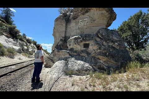
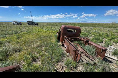
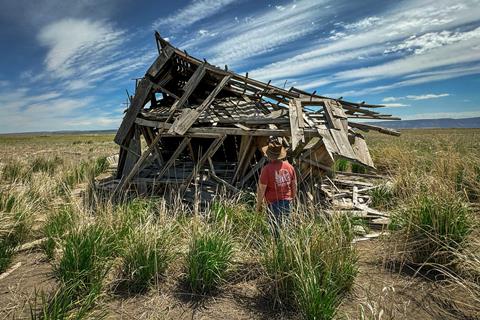
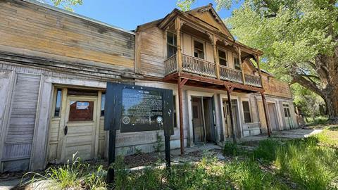
Amidst these vast holdings lay the dusty bones of various ghost towns. We stopped to explore Blitzen, which sprang up as a small farming settlement. One wonders why anyone would plant roots smack dab in the middle of a vast sage desert sans any visible source of water?
But its population grew to the point that the U.S. Postal Service established an office. Oregon winters can be harsh, and all that remains are the decaying skeletons of lives forgotten.
Ranchers and Renegades
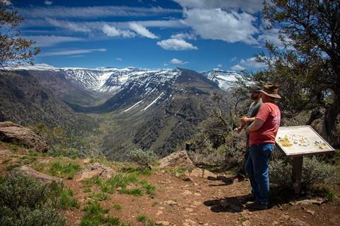
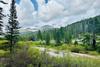
Originally deemed the Snowy Mountains by John Work, a fur trader and director of the Hudson Bay Company, the 4,000-foot-high basalt uplift now known as The Steens stretches 50 miles in length north to south.
Again, being early in the year, we were told the track over the summit was closed, but as the curious guys we are…we needed to confirm.
Closed it was, but the 49-mile loop provided a glimpse into the land of the Paiute Indians and an epoch when volcanoes and shifting tectonic plates crafted the Earth’s landscape.
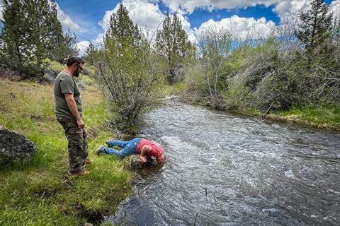
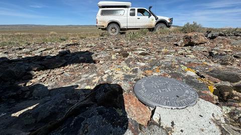
We also located some great sideroads and stealth camps, and Will performed his traditional head-plunge in icy Indian Creek. Our lunch stop near the 7,500-foot summit overlooked Big Indian Trail (hiking path), which threaded its way up a precipitous canyon reminiscent of the Swiss Alps.
We sneaked into the Frenchglen Mercantile pump just before the witching hour, and topped off with the cheapest fuel within 30 miles as the crow flies (a mere $5.90/gal. Take a photo and show it to the clerk inside).
No complaints, as one of the golden rules of backcountry travel is to fuel up whenever you can. As you might surmise by the name, the town was established around the time of the French-Glenn Ranch.
Today, the well-preserved hotel is on the National Register of Historic Places and quite popular with high-heeling tourists visiting the adjacent Malheur National Wildlife Refuge. With a population of 12, Frenchglen is usually a pretty sleepy little town.
That was until January 2016 when Southern Nevada ranchers Ryan and Ammon Bundy, along with a group of supporters (some armed), seized control of the Malheur park’s HQ.
Disgruntled over their father’s decade-long dispute with the BLM over restricted grazing rights (due to new ESA protections of the Desert Tortoise), the two decided to take on the Federal Government. They declared that under the 1848 Treaty of Guadalupe and various other statutes, the government had no right to restrict public use of public lands.
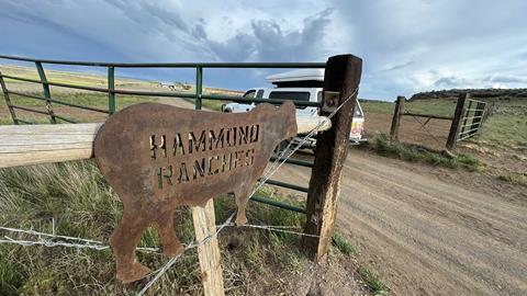
Why they selected Malheur was largely in support of the Hammon family, 7th generation ranchers that had lost their 140-year grazing rights to what is now part of the reserve. The Hammons ripped out fences, issued death threats, lit backcountry fires, were convicted of arson, and ended up in prison.
Some declared the Bundys “Domestic Terrorists,” while others rallied behind them as patriotic heroes. Thousands attended Cliven Bundy’s regular press conferences, and several right-wing groups showed up unannounced offering to join the fight. The offers were declined, but after a 40-day standoff, things did not end well for Bundy and crew.
Fellow rancher and group spokesman Robert LaVoy Finicum was shot and killed during an attempted arrest, Ryan Bundy was wounded, and two dozen were arrested on Federal conspiracy charges.
The entire saga is fodder for a “Yellowstone” script, and evidence that the gunslinging Wild West is still alive and fighting. Frenchglen and the park have been quiet for years, and a drive around the marshy lowlands is a stark contrast to the endless sage of the high desert.
The Alvord
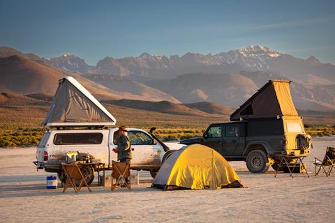
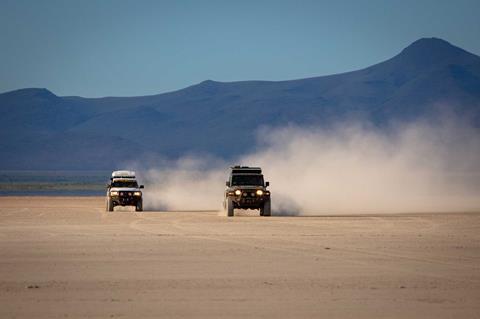
The rest of the day was spent doing a 110-mile zigzag over hill and dale, making our way through Diamond Valley, Paddle Meadows, and Leppy Springs before finding Mickey Hot Spring. Dropping off the Steen Mountains, the Alvord dry lake stretched southward.

Finding a quiet spot on the southern end of the playa, we turned off the engines and absorbed the absence of all modern-day distractions.
If the name Alvord rings a bell, its 12-mile-long alkali flat has been the site of numerous land speed records, including that of the late great Jessi Combs. Reaching 522.783 miles per hour, Jessi posthumously holds the title of The Fastest Woman on Earth.
Having known Jessi personally, we poured a few rounds in her honor and settled in for extended yarns about living life to its fullest and with no regrets. Jessi optimized this mantra. Rest in peace my friend.
The chronicle of Wild West shootouts continued with the nearby Alvord Ranch, the first employer of buckaroo, Vietnam War draft dodger, and convicted murderer Claude Dallas. After his trial for draft evasion, he disappeared into the mountains south of the Alvord, trapping and poaching game.
In April of 1982, he shot and killed two game wardens, execution style with a 22 round to the back of the head, dumped their bodies, and lived on the lam for four years before being captured.
After serving 22 years in prison, he again vanished into the remote reaches of the Pacific Northwest. This type of tale makes one question the various hermits you come in contact with living off the land deep in the bush.
Our next leg took us through Whitehorse Ranch, established in 1869 by John S. Devine and continuously operated to this day. We had considered a dip in the Willow Hot Springs, but upon arrival found a heavy-set old guy, buck-naked and proud of it, exposing himself to the world.
We skipped the dip and moved on around Mahogany Ridge, Beaver Log Spring, and north toward Locust Spring. The sun was getting low on the horizon and a brisk wind whipped across the 6,800-foot plateau. Turning down the cliff-edge switchback to Twelve Mile Creek, it hammered against our rigs until we descended below the ridgeline.
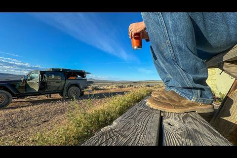
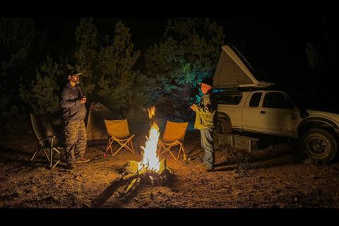
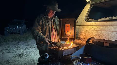
Our final night was on a powerline road near Schoolhouse Hill. Cutting a wide firebreak for a campfire, we grilled steaks (appropriate when in cattle country), and recapped the previous days. We had covered about 700 miles since departing Plush, most of it on dirt, and absorbed a wealth of history on Oregon cattle country.
If I mentioned the television show Yellowstone, the tales associated with this remote corner of the Wild West could easily have been inspiration. Family roots dating back to the 1860s, fatal feuds over grazing rights, murder, and deception. The script aligned perfectly.
Escaping with our hides, we jumped on the pavement at Highway 95. Josh headed north to find the burial site of Sacajawea’s son Pomp, while Will and I headed south to Paradise Valley. We had lunch just a few miles from where Claude Dallas did his dirty deeds…and those might be yarns for another campfire.
Access More Great Stories!
This article originally appeared in OVR Issue 11. For more informative articles like this, consider subscribing to OVR Magazine in print or digital versions here. You can also find the print edition of OVR at your local newsstand by using our Magazine Finder.
No comments yet